One Day Trips in the Meadview Area


DIAMOND CREEK - Drive either Buck and Doe Road (on the Hualapai
Reservation) or Antares Road to Peach Springs (capitol of the Hualapai
Indian Nation). You must get a permit from Hualapai Fish and Game to
drive 21 miles to the only place that you can reach the Colorado River
on the South side.
WILLOW BEACH
- 76 miles from Meadview at milepost 14 off highway
93. Boat ramp and fishing. Excellent scenery of Colorado River 11 miles
below Hoover Dam. Willow Beach now has a beautiful campground, fishing and boat docks, rental boats, and a big supply marina
store.
After a flood washed
out the older store and motel, NPS contracted with another
concessionaire to really spruce up the place. Click on
 for info.
GRAND CANYON CAVERNS - Take Antares Road
(not paved) to Route 66
and drive the entire way 10 miles east of Peach Springs. An
alternate route, would be Stockton Hill Road to Kingman,
(and it is
PAVED). Go east on Route 40 to the next exit (Andy Divine) go
left on Andy Divine to Peach Springs. The Caverns are approximately 10
miles East of Peach Springs.. It is the
largest dry cave in
the US, 95 miles from Meadview. It is a fee area. An elevator drops you 210 feet
to the floor of the cavern.
Only 3 out of every 100 caverns in the world are dry. This makes
the Grand Canyon Caverns very unique. Click on
 for a peek.
HUALAPAI MOUNTAIN PARK - 8300 feet in a pine forest. Lower
southern end has saguaro. Many famous mines within the 40 mile length of
the range can be visited. On eastern slope is the Gold King
Mansion. Click on
 for info.
GOLDROAD / OATMAN
- 1900 boomtowns - gold mines (one still in
operation). 100 miles from Meadview through Kingman to exit 44 on I-40.
This is the old route 66. Cross Sacramento valley, climb the volcanic
Black Mountains. Visit the hotel where Carole Lombard and Clark Gable spent
their honeymoon. Click on
 for info.
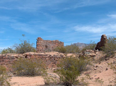
BRECHNER STONE CABIN - Turn onto Gregg's Hideout Road from Pearce
Ferry Rd - cabin is located to the left beyond the Temple Bar turnoff.
Dated 1859. You need a guide the first time to locate the cabin.
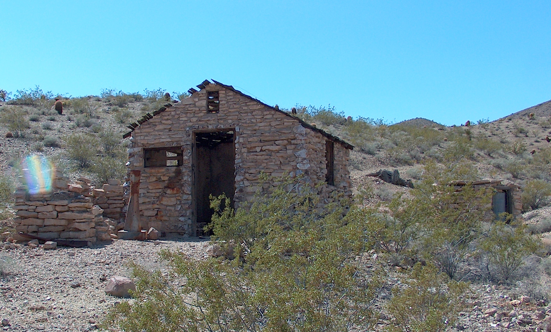
Brechner's Cabin
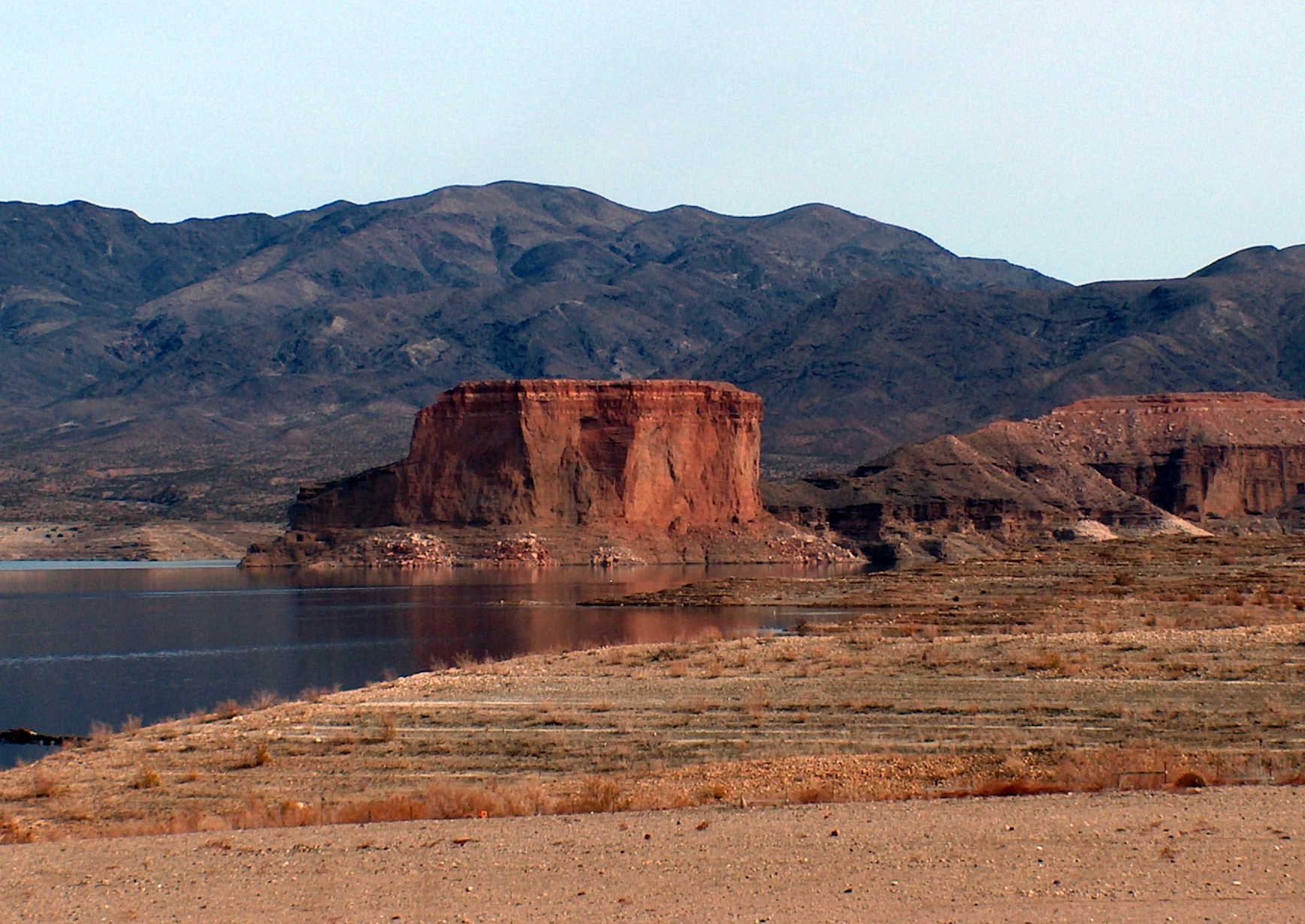
Temple Bar
TEMPLE BAR VIA BACK ROAD - Take Bluebird Canyon down to Hualapai
Wash, backtrack to Gregg's Hideout Road, watch for sign at Temple Bar
turnoff. Follow dirt road to Temple Bar or turn off Pearce Ferry Road
onto Gregg's Hideout Road and watch for Temple Bar turnoff. Interesting
mines, views of Lake Mead. Click on
 for info.
GRAPEVINE WASH / SPRING HIKING TRAILS / ROASTING PITS / PEARCE
FERRY / DRY FALLS / GYPSUM CLIFFS
-East on Meadview Blvd. in Meadview,
turn right on Shore and left onto BLM 145. Follow road north into wash,
pass Lucky 7 windmill, turn right into next wash then right again to
find Anasazi Yucca Roasting Pits. 1/2 mile south of Grapevine Springs
turn right into Lost Cable. A 6 to 6 1/2 mile hike to Dry Falls and the
two canyons in back. Hike up Grapevine Springs Canyon but be prepared to
climb up three small waterfalls. Gypsum cliffs on both sides of wash 2
miles north. Pearce Ferry Landing can be reached if you continue to the
north arriving at the lake edge. Over the ridge is what is left of a
mining site. Grapevine wash was known as the Old
Ute Trail, and was used
for hundreds of years by the Anasazi Indians crossing the Colorado River. They
either turned left at what is now the Diamond Bar Ranch to travel to the
Hopi Mesa, or right to go to California.
POPE MINE / CHALCEDONY WASH - Turn left at milepost 25 on highway
93. Follow dirt road to mine, fairly well posted, then continue down
road for 9 miles. Chalcedony found laying on the ground and up into the
light colored hills. Continue down road 1/2 mile to reach Colorado
River. You need a guide
SECRET PASS
/ HIDDEN ARCH - From highway 68 turn left on Estrella.
Turn right and follow dirt road. Secret Pass entrance is difficult to
find but the hike is fantastic. This is the trail used from Mineral Park
into the Oatman area mines. Further down the road turn left and park.
Hidden Arch is up in the heavy rock formations above the parking area.
You need a guide.
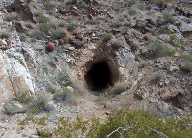
CYCLOPIC / FRY / OWENS MINES - Turn off
Pearce Ferry at mile 16. Dirt road into low hills. Cyclopic is an open
pit gold mine. Owens is located on Senator Mountain. Some of these mines
are again in production.
PATAYA ROAD - The road just beyond the Music Mountain Road turns
right across and just southeast of the dry lake, Red Lake. This was an
old Indian route that now intersects with Stockton Hill Road.
WINDY POINT / PACKSADDLE PICNIC AREA - Turn at milepost 51 off
highway 93. Follow road to top. Great picnic and hiking area. Continuing
on that road you can hike the 2 mile trail up Cherum Peak.
Take plenty of water and plan on a long, strenuous hike up to the
top, 6800 feet, and back down. Following the road you find many mines
and eventually circle back to Chloride. This is a wild horse range for
the remaining herd of 110 horses with bloodlines of the Sorraias horses
brought by the first Spaniards.
KATHERINE'S MINE - At milepost 46 on highway
93, turn right and follow dirt road to cove. Interesting mine activity
to the right going down cut. Turn left before starting down cut and
follow road into Katherine's Mine area. Road closed at steep gorge. Very
interesting 4x4 drive. Some working mines in the area.
MUSIC MOUNTAIN MINES / CLAY SPRINGS RANCH / HELL'S CANYON - Off Antares Rd turn left at first road. Follow road around Willow Canyon
Ranch and up a steep, shale-covered road. This is Hell's Canyon and it
ends on Hualapai reservation land. Continuing on Antares, the next road
is to the Clay Springs Ranch. Continue up the steep grade to intersect
the Buck and Doe road. Back on Antares Road, you next come to the Music
Mountain Mill along the road. The next road left takes you to many
mines, including Ellen Jane, Rosebud, Lucky Cuss, Bonanza King. A steep
road leads over the mountain and back to the Clay Springs Road.
On Music Mountain Rattlesnake
Canyon
GOLD BASIN MINES - Includes Blue Bird, Gold Hill, Golden Gate, Malco, Excelsior, Senator, Owens, Fry, and King Tut mines. Unique fossil "strewn" meteorite fragments have
been found over a wide area here. Largest collection ever found outside
Antarctica with many still there. Peanut to softball size fragments. For
more click on:

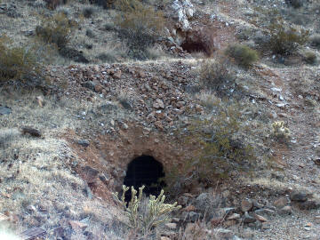
Bluebird Mine Golden Gate Mine
Burnt
Mill
GOLD BASIN CEMETERY -
Located off Gregg's Hideout Road on right. What remains of the mill is
above
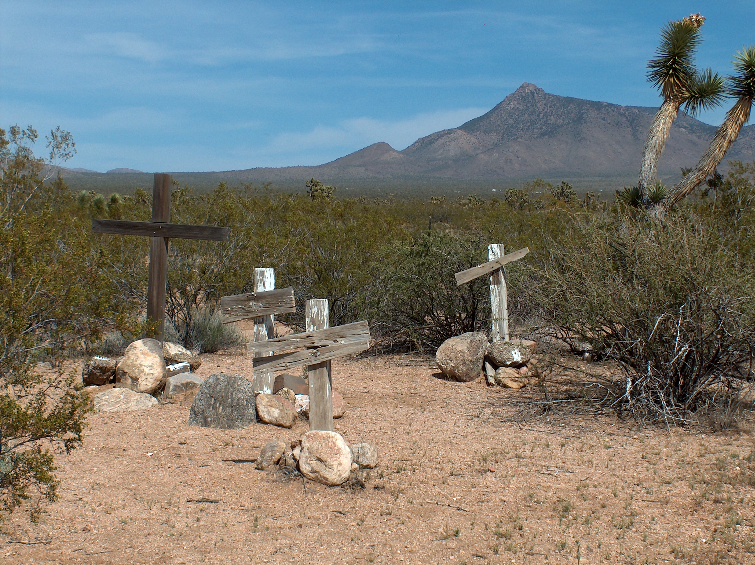
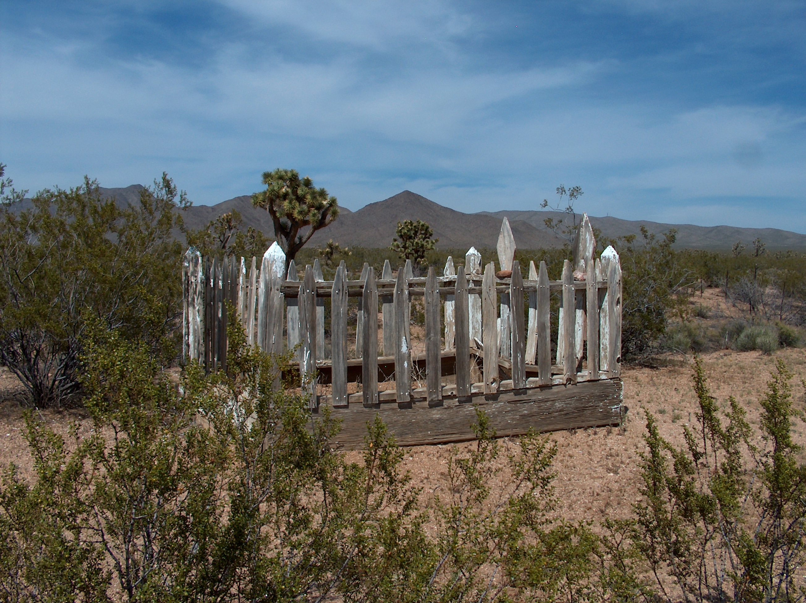
Burnt
Mill Cemetery
TODD
BASIN MINES
-
Off highway 93 at milepost 56, turn left. Go around the sludge pond and up the
road. Many skeletons of buildings are left. One mine has arsenate crystals
covering walls of the tunnel. A guide would help.
IRON
MOUNTAIN GARNET MINE - Just past the Diamond Bar Ranch turn right on road
and follow up the mountain. Ray's Place is still standing with a large apricot
tree. Road is washed out very badly. Follow to top - hiking is best. The view of
Red Lake is great. Deep garnet mine is on outside of mountain looking onto Red Lake.
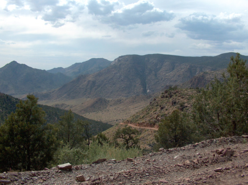
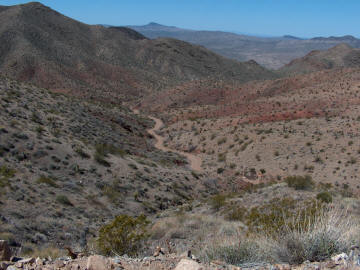
MEADVIEW OVERLOOK / LAKE MEAD CITY
OVERLOOK - Follow Diamond Bar
(Grand Canyon West) Road. Just before Hualapai reservation signs, turn
left. Continue with turns to left at fork. The first road goes to Lake
Mead City overlook and the second ends at the Meadview overlook. The
main road continues to the right with an overlook of Grand Canyon West
airstrip A guide is very helpful to find these overlooks and the Anasazi
roasting pits and caves
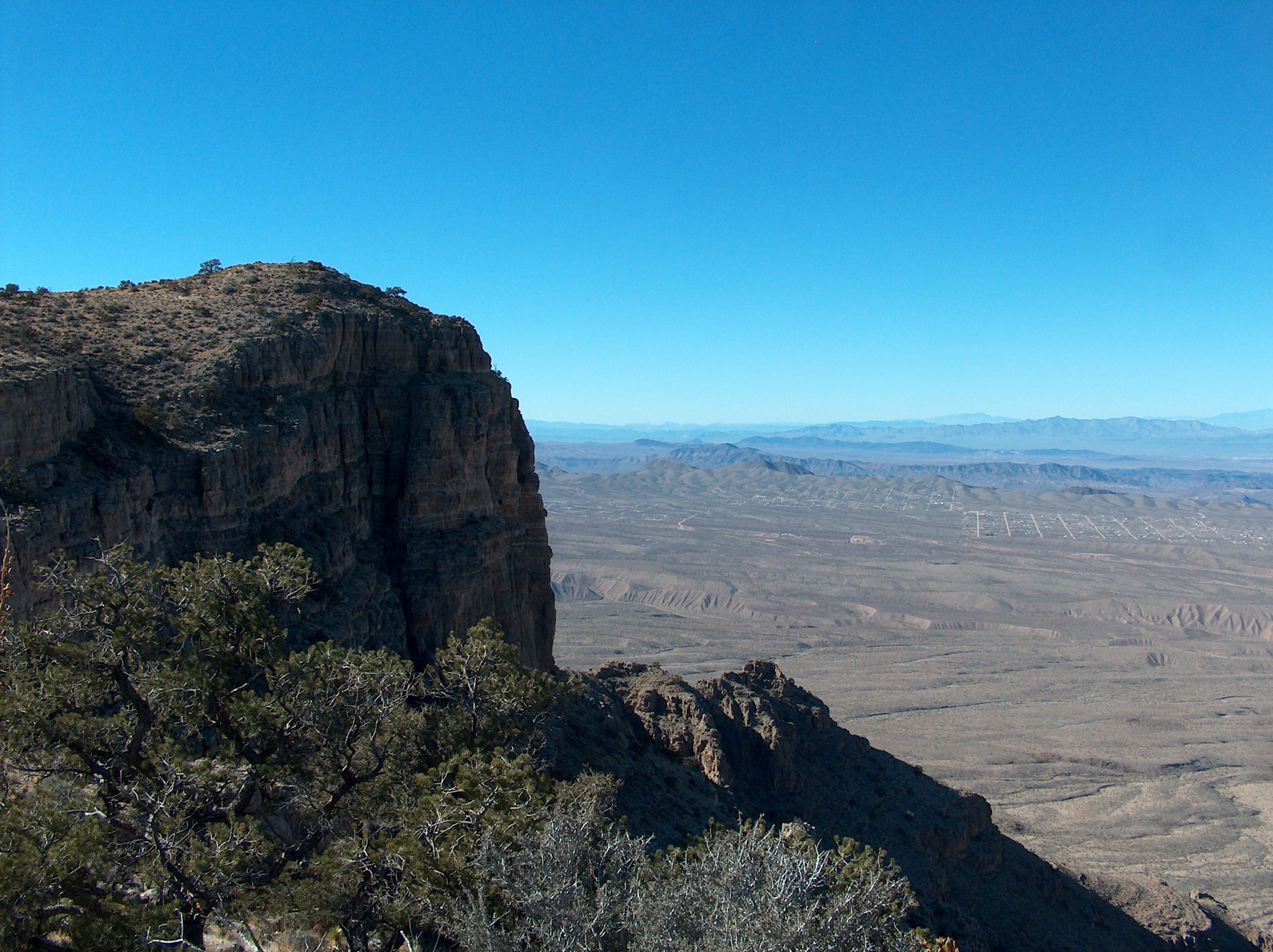
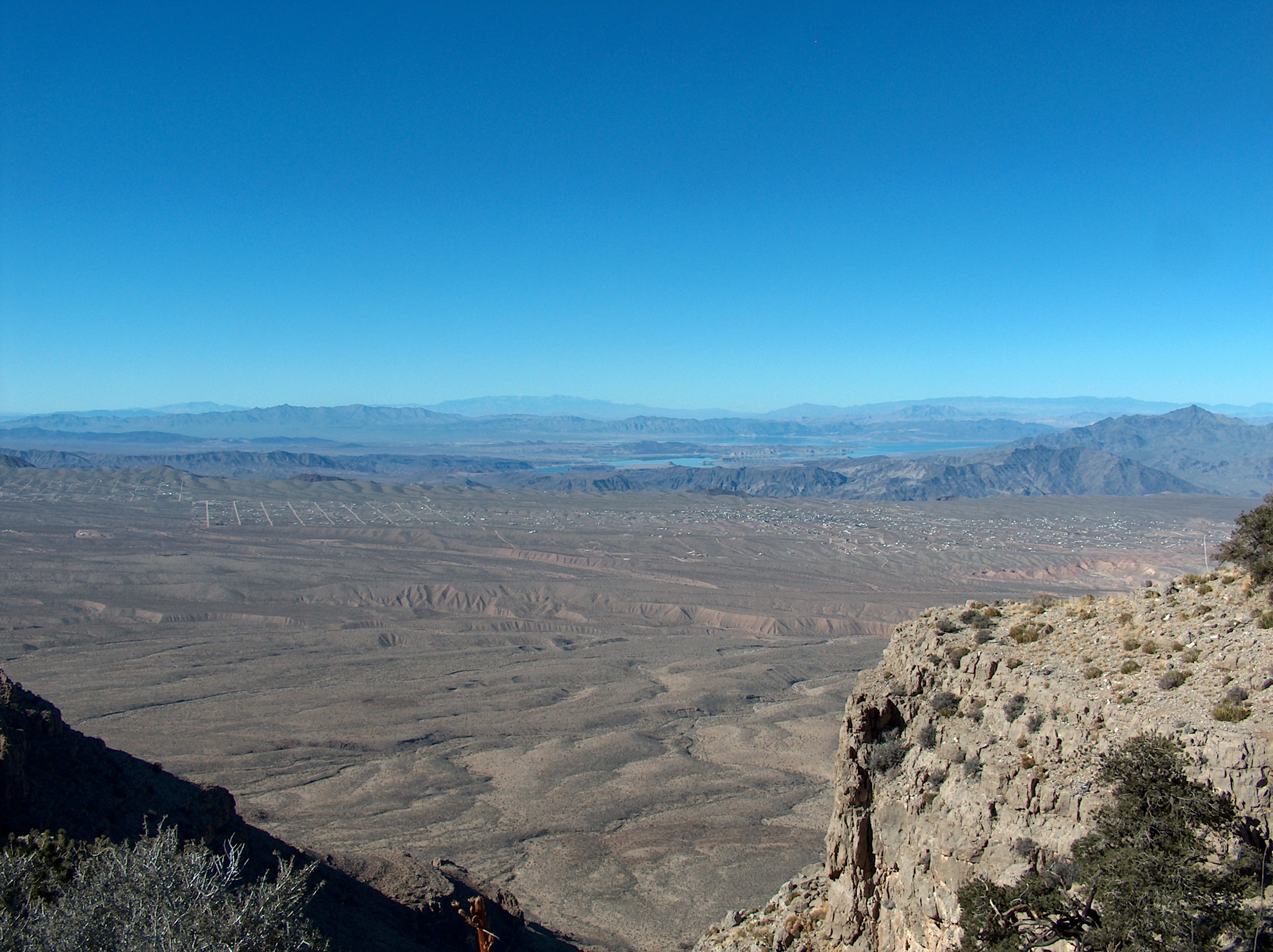
Overlooking Mead City)
(Overlooking Meadview)
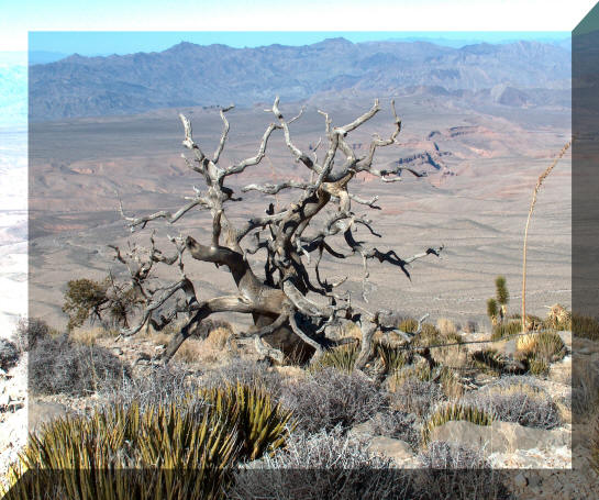
A parched pinion pine on Grand Wash Overlook
(Photos by Annie)
PETROGLYPH WASH / BONELLI LANDING / JAMES BAY -Turn
off highway 93 at milepost 20 (Temple Bar turnoff) and then turn left at
Bonelli turnoff. Bonelli is to your right. The turnoff to Petroglyph
Wash is to your left on NPS 71. There is a loop road. The road to James
Bay is NPS 73. Old Pope Mine is NPS 72. The area has many petroglyphs.
FIG SPRINGS - This is on the old Gold road. Leave Route 66 eleven
miles beyond the McConnico turnoff, then turn on Navajo - to Garnet - to
Dawson...... Dawson is a narrow, rocky dirt road. One mile to the west,
against the volcanic rocks, you will find two springs, a marsh, two rock
houses, a swimming pool and a rock enclosed yard with a rock barbecue
and mesquite and palo verde trees. At the edge of the cattail filled
marsh is a fig tree that, according to history buffs, was planted by
Friar Garces when he and Indian guides passed through the area in 1776.
Back to Top
Questions or comments about the website? E-Mail the webmaster.

Revised 03/09/2019
This page and all attached pages © 2001 - 2019 Meadview RV Park